03 April 2019
Plains of Abraham, from a historic battlefield to a picturesque park

With a prime location right next to the Voltigeurs de Québec Armoury, the Plains of Abraham are one of Québec City’s main attractions. And for good reason! Not only are they steeped in history and local heritage, but they also happen to be located on a gorgeous natural site. The battles that took place here in 1759 and 1760 left their mark on the collective memory, and over the years the expanse of rolling hills has been used for many different purposes. Let’s take a look back.
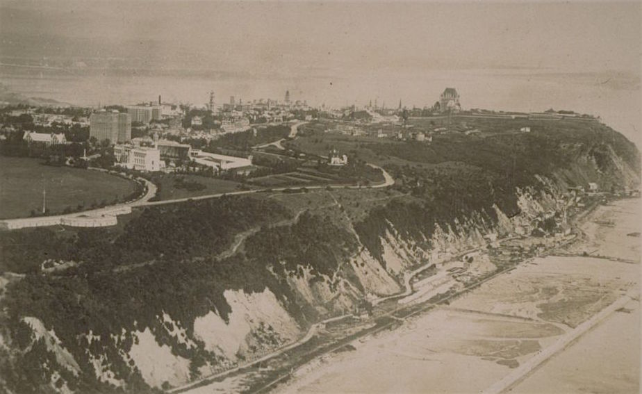
A breathtaking view of the St. Lawrence
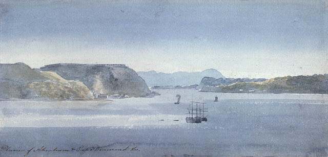
The Plains of Abraham are located on the promontory of Québec, where the cliffs plunge abruptly and the river narrows. This geological formation was dubbed Cap Diamant in a nod to the great explorer Jacques Cartier, who thought he would find precious stones there in the 1530s. While there may not be diamonds hidden there, the site is indeed a gem—it offers a spectacular view of the St. Lawrence River.
When the French first settled in Québec, they immediately noticed the potential of the Plains. They had good drainage and were exposed to high winds, so settlers set up small farms and several mills there. Their name comes from Abraham Martin, called “The Scot,” a ship pilot who owned a small portion of the promontory in the 17th century.
While the name “the Heights of Abraham” was most likely in wide use by locals during the New France period, it only began to appear in official documents toward the very end of the French Regime.
Military clashes
The Plains of Abraham were also strategically important, as the leaders of New France knew right away. Colonial authorities established a military presence there to keep an eye on the river.
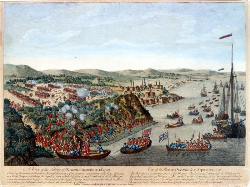
During the Seven Years’ War, two major battles were fought on the promontory, with the Canadian and French armies facing off against the British. The first confrontation began in summer 1759, when the English fleet and army led by James Wolfe showed up at the foot of Québec. A siege ensued. The city was bombarded day and night for weeks, while entire villages across the St. Lawrence were burned and razed. Under the orders of Marquis Louis-Joseph de Montcalm, the French army set up camp in Beauport, not far from the Montmorency Falls, thinking that the attack would come from that direction. But on the night of September 13, Wolfe and his 4,800 top soldiers managed to scale the 100-meter-high cliff to take the city by the west flank. Montcalm desperately rushed back to Québec with his soldiers and militiamen to make a stand against the English. But after a mere 20 minutes of fighting and some ill-fated maneuvers, the French were defeated. Mortally wounded, Wolfe’s last words were: “I die content.” Montcalm was also injured and died 24 hours later. The besieged Québec surrendered five days later.
A second battle was fought on the Plains of Abraham the following spring. The French, led by Louis-Antoine de Bougainville, were attempting to take back enemy-occupied Québec City. This time the French forces emerged victorious, but the arrival of English supply ships gave the British the upper hand again. After a period of military administration from 1760 to 1763, the colony’s fate was sealed, thousands of kilometers away, with the signing of the Treaty of Paris. New France—including Québec City—was officially handed over to Britain.
The British continued to use the names “Heights of Abraham” and later “Plains of Abraham” to designate the site, perhaps appreciating the Biblical connotation. There they built an impressive citadel to take advantage of the strategic location, and it became an important component of the city’s defenses. Hulking Martello towers were built in the early 19th century to fend off an American invasion.
Surprising uses and memorable events
The Plains of Abraham were used for a variety of activities over the course of the 19th and 20th centuries.
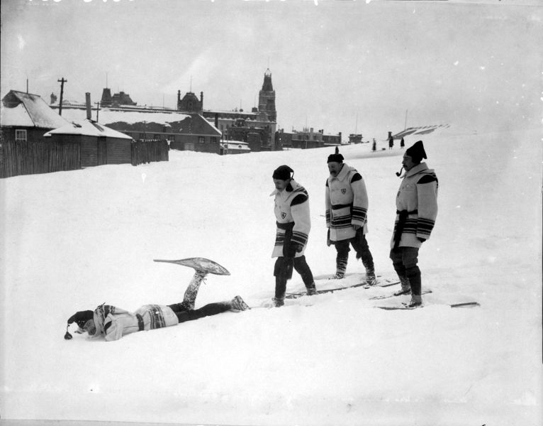
They were—and still are!—used for sports of all sorts. Snowshoers, cross-country skiers, and practitioners of other winter sports flocked there, as did players of cricket, lacrosse, and football. The military even held horse races there! In 1897 Buffalo Bill and his Wild West troupe of 300 riders performed on the spacious plains. The members of the Québec Golf Club also played there for decades, from 1874 to 1915.
The area known as Cove Fields included an armoury, an ammunition warehouse, and a firing range. During World War II, these military facilities were converted into a hospital and, shockingly, a concentration camp. The buildings were then given to impoverished families in the late 1940s in response to the growing housing crisis, earning it a reputation as a “slum town” within the city. The buildings were ultimately demolished in 1952.
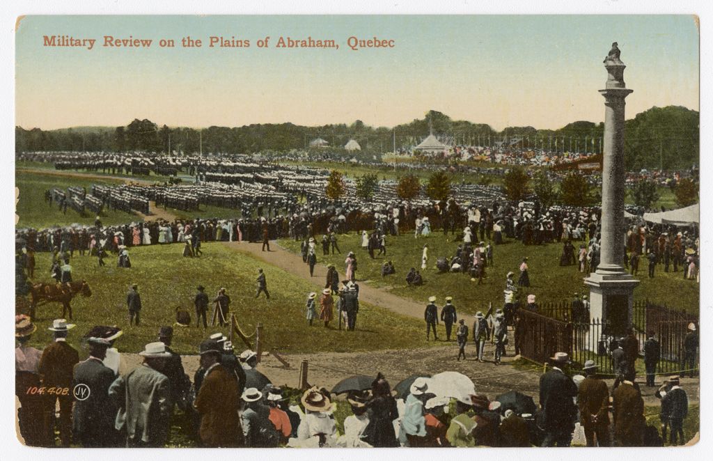
The natural amphitheater created by the hills and valleys also made the site the perfect spot for big rallies and celebrations. One of the earliest was the National Convention organized by the Société Saint-Jean-Baptiste de Québec on June 24, 1880. Other large-scale gatherings included the June 1938 Eucharistic Congress, which drew more than 100,000 visitors, and the SuperFrancoFête, an international francophone youth festival, that attracted more than 125,000 in August 1974. Many of the Québec Winter Carnival activities have taken place on the Plains for years, including an international snow sculpture competition. And to this day, the Québec City Summer Festival stages performances in this venue with a view.
Battlefields Park
In 1908, to mark Québec City’s 300th anniversary, a considerable portion of the Plains of Abraham was turned into a park. Landscape architect Frederick G. Todd was entrusted with the task. He designed the new park with deep respect for the natural topography, creating curved paths and winding walkways, and planting thousands of trees, shrubs, and ornamental flowers, including some of the first mosaiculture installations in Canada.
The tricentennial celebrations and the grand opening of the park were of epic proportions. There was a pageant with 4,500 people in costume, a big military parade, and festivities on the water featuring six British, one American, and two French warships. A commemorative medal was minted and eight postal stamps were issued for the occasion.
The 100-hectare Battlefields Park is now overseen by the Canadian government. As you would expect, it features many monuments to our military past, including ones honoring the generals who fell there—James Wolfe and Louis-Joseph de Montcalm—and a statue of Joan of Arc inaugurated in 1938 as a symbol of the courage of those who fought on the Plains. But that’s not all: the site also boasts some 50 commemorative plaques, the Cross of Sacrifice, and—a kid favorite—cannons from different time periods.
The Plains of Abraham today
Every year millions of people—locals and tourists alike—take advantage of the beautiful Plains of Abraham to play sports, catch a performance, or simply relax.
If you want to appreciate the culture of the place as well, start with a visit of the Plains of Abraham Museum. Located right next to the Armoury, it has a permanent exhibition on the site’s history. Then mosey your way along the hilly trails to the west, or take Avenue George-VI and keep an eye out for historical markers, including the exquisite Joan of Arc Garden, and stop at the Musée national des beaux-arts du Québec. Opened in 1933, the museum has grown and expanded over the years, most recently adding the luminous Pierre Lassonde Pavilion. By then you’ll be ready for a bite at one of the many restaurants in the Montcalm district, whose colorful main drag, Avenue Cartier, abuts the Plains. Feel free to download the map to help you find your way and make the most of your visit.